
Air Quality
Ambient air quality for Kitimat and Area
The Province of B.C.’s live air data tools show current, recent, and past information from ambient air quality and weather monitoring stations across the province. Ambient air means the outdoor air around us.
For Kitimat-area information, residents can use the Coastal Air Zone data. This includes monitoring stations in and around the Kitimat area and helps show what is being measured locally.
This information can help community members:
- see recent air quality conditions
- check which pollutants are being measured
- compare readings between monitoring stations
- understand how weather, such as wind direction, may affect air quality
- make informed choices about outdoor activities, especially during smoke or poor air quality events
Airshed Boundary
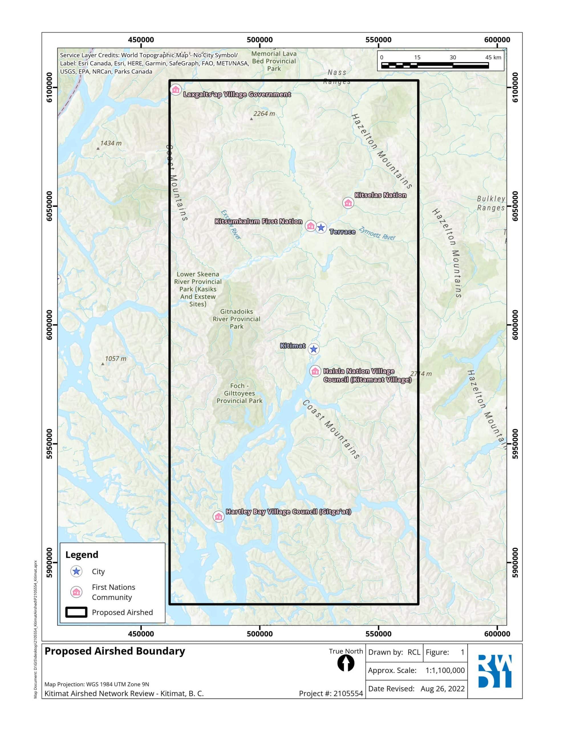
How to Read the Data
In the Coastal Air Zone table, each row represents a monitoring station. Each column shows a different pollutant or weather measurement.
Look for stations in the Kitimat area, then read across the row to see the latest available air quality and weather data for that location.
What the columns mean
The data table may include more measurements than those highlighted on this website. In addition to key pollutants such as PM2.5, PM10, SO₂, and NO₂, the table may also show other pollutants and weather information, such as wind speed, wind direction, temperature, humidity, precipitation, and barometric pressure.
To learn more about these pollutants, where they come from, and why they matter for health, visit the Understanding Air Pollutants page.
What to keep in mind
The data shown on the Ministry site is preliminary. This means it is available before all quality checks are complete and may change after review. The Ministry notes that air quality data is reported in Pacific Standard Time and that final reviews can take place later.
Some readings may be missing for certain stations or time periods. This can happen because of equipment maintenance, calibration, communication issues, or because a station does not measure every pollutant.
For health guidance
This table shows measured data, but it does not always explain what the numbers mean for your health. For health advice, check the AQHI page, which explains the Air Quality Health Index and what each risk level means.